Wharves and Vessels on Canvas and Paper
Fitz Henry Lane’s Legacy of Maritime Representation
By Erik Ronnberg
July 5, 2023
Originally published 2022 in Gloucester Encounters: Essays on the Cultural History of the City 1623–2023, edited by Martin Ray and published by Gloucester Cultural Initiative. Available for purchase at gloucesterculture.org.

Figure 1. Fitz Henry Lane (1804–1865), The Old Fort and Ten Pound Island, Gloucester, c.1850s, oil on canvas. Cape Ann Museum, Gloucester, MA. Deposited by the Collection of Addison Gilbert Hospital, 1978.
My father’s rigging loft in the 1940s and 1950s was right at the foot of Sherman Ruth’s wharf, where the Americold freezer plant is today. He had learned his trade on Swedish sailing ships before emigrating to America. When I was a year old, he brought us here from Maine, and the Gloucester waterfront has fascinated me ever since. We ship-model makers try to take in every detail of life afloat and in the harbor. For local historical research, we owe a great debt to the depictions made by Fitz Henry Lane (1804–1865). His drawings and paintings are documents, really, with valuable information for both art scholars and maritime scholars on seafaring life in the mid-19th century, when Gloucester was becoming one of the great fishing ports of the world. Lane’s career and interests span just the right period to portray the development of shoreline facilities and the evolution of the working fleet in ventures for coastal shipping, foreign trade, and, ultimately, fishing schooners.
A Meticulous Observer of Vessels in the Harbor
Lane is well known for his atmospheric paintings, luminous treatments of sea and sky, but he was as meticulous in his medium as any model maker I know. Many of the books on seamanship from this period are very accurately illustrated when it comes to vessel proportions and rigs and that sort of thing, so it seems pretty obvious that Lane studied those depictions in addition to closely observing the vessels he saw here in Gloucester and in Boston. He must have done a lot of reading, a lot of research. We can be grateful for that.
One painting in the Lane Gallery at the Cape Ann Museum, The Old Fort and Ten Pound Island, Gloucester, although executed in the late 1850s, retrospectively shows a defensive position as it looked in 1844 at the entrance to the inner harbor on Fort Point; Fort Defiance had stood since the Revolution and the War of 1812. There wasn’t much wharfage at that location in the 1840s, just a few stone piers and timber wharves. Boulders still cluttered the shoreline. Shipping activity was concentrated farther in at Harbor Cove and Duncan Point.
Foreign trade was so important in that period of Gloucester’s maritime development that the fishermen had pretty much given up on harbor space; fishing boats were mostly berthed over in Annisquam and Lanesville, Pigeon Cove, and Rockport. That continued until the Suriname trade with South America started to ebb in the 1840s and ’50s. As some of those traders moved their offices to Boston, space in the harbor became more available. The fishermen saw that they could return to Gloucester Harbor, where they could berth more and larger vessels for the Banks fisheries to satisfy the growing demand for fish. The railroads were expanding then and serving more and more markets for fish in other parts of the country.
Figure 2. Fitz Henry Lane (1804–1865), Ten Pound Island, Gloucester, c.1850s, oil on canvas. Cape Ann Museum, Gloucester, MA. Gift of Bessie Stanwood, 1948 (1238).
The boat on the right side of The Old Fort and Ten Pound Island, Gloucester (fig. 1) is a pinky, a very common vessel for near-shore fishing off Cape Ann. Not many of them made trips to the Banks, because they were too small for what they caught and for the effort it took to get those fish. The little topsail schooner at the center of the painting is in the coastal trade, not a fishing vessel. Another pinky is under sail at the far left. The big three-master is probably a merchant ship. It could have been in the Suriname trade or other foreign trade, because a few ships still sailed to Europe and beyond.
The sloop under sail in the center background is deep in the water. Lord knows what she has on board. Some sloops were carrying stone for wharfage and such, but she’s too small for much of that work. The sloop in the left foreground with her sail down could be a pleasure boat visiting Gloucester, looking for a place to anchor. The man at the helm is too well dressed for fishing.
A similar scene from the 1850s, Ten Pound Island, Gloucester (fig. 2), is situated on Fort Point, just around the corner from the previous vista. They’re building a couple of wharves at the very end of the point. If you drive out there today and look down at the water, you will see the remains of those wharves. They’re set at angles to the shoreline because wharf extensions couldn’t go past the harbor limit.
The logs on the ground are sharpened wharf spiles waiting to be driven down into the muck with some kind of a pile-driving device. These fender spiles, also called pilings, are spaced at intervals along the wharf to keep the vessels from rubbing up against the stone when they tie up. Iron ties will secure them to the wharf at the top. Another painting in the museum’s Lane Gallery, On the Wharves, Gloucester Harbor (1847), shows this arrangement very well. We’re fortunate to have such a wealth of Lane’s work here.
Lane Portrays the Undeveloped Shoreline
Fitz Henry Lane (1804–1865), View of Gloucester from Rocky Neck, 1846, lithograph on paper. Cape Ann Museum, Gloucester, MA. Gift of Mrs. Bertha Procter (1139.2).
Ten Pound Island, Gloucester (fig. 2) might have been painted fifteen years later than the first one, judging by the more finished stonework, which you could call a finger pier. It’s a forerunner of what was to come. A lot of the wooden wharves were rotten and going to pieces, being replaced with stone. Quarrying had started earlier and was building up momentum in this period.
The vessel under sail is a half-brig, or hermaphrodite brig. She’s square-rigged on the foremast, and fore-and-aft-rigged on the main. At this point, the Suriname trade had practically disappeared from Gloucester, so I suspect that some of these square-rigged vessels were shipping cod to Europe. It’s quite possibly a salt ship.
In the foreground Lane has painted a coasting schooner with a great load of lumber on deck, likely from Maine. A similar craft to her left, with a little sloop alongside, was probably engaged in general coastal trading.
The rowing vessel that’s hauled out on shore is a double-ended boat. Nothing about her identifies her being in any particular fishery, if she was in the fisheries at all. A boat that heavy took a few men to make her move. She may have had a detachable mast and sail to help get her under way. The barrels might be for packing salt fish.
In Lane’s 1846 lithograph View of Gloucester from Rocky Neck, you can see the beginnings of the expansion of the fisheries just before the huge construction boom. With the Suriname traders gone to Boston, the fishermen could get wharf space again, but it wasn’t until the 1850s that the shoreline became much more elaborated with buildings.
The vessel in the center is probably a ship in the foreign trade, perhaps headed to Spain or Portugal. Some even went as far as China, I believe. It’s a bark, square-rigged on the fore and main masts, but with no square-sails on her mizzen, the rearmost mast. On the far left is another hermaphrodite brig. Interestingly, there’s a steamboat passing by it. Some off-and-on attempts had been made to use steamers between Gloucester and Boston. Probably the merchants in the Suriname and other foreign trades would have benefited from this kind of service, which pretty much ended when that trade collapsed, only to be rebuilt when tourism arrived a few decades later.
Figure 3. Fitz Henry Lane (1804–1865), Gloucester Harbor from Rocky Neck, 1844, oil on canvas. Cape Ann Museum, Gloucester, MA. Gift of Mrs. Jane Parker Stacy (Mrs. George O. Stacy), 1948 (1289.1a).
In his 1844 painting, Gloucester Harbor from Rocky Neck (fig. 3), Lane has placed a brig and a half-brig at anchor in the center and a topsail schooner by Fort Point, which is relatively undeveloped, as is Duncan Point on the right. Small schooners are entering the scene from both the left and right. In the foreground is a yawl-rigged pleasure boat on a sightseeing tour.
The Era of Fisheries Expansion
Lane’s 1859 lithograph, View of Gloucester (fig. 4), depicts all kinds of industry along the waterfront, including both the Burnham and the Parkhurst Marine Railways. The fisheries have become the dominant activity. The older buildings along Harbor Cove, which originally served the Suriname trade, are now for fish.
Fort Defiance has been completely stripped of boulders for house foundations elsewhere in Gloucester. Duncan’s Point, and especially the head of the harbor, lagged behind in development until a massive dredging project in the 1870s gave them deep water right up to the wharves. Prior to that, a boat of any size tied up alongside a pier would ground out at low tide or close to it. The muck and stones had to be cleared out to make the harbor useful for the larger and deeper schooners that were coming in.
Figure 4. Fitz Henry Lane (1804–1865), View of Gloucester, Mass., 1859, lithograph on paper. Cape Ann Museum, Gloucester, MA. Gift of Mrs. Bertha Procter, 1940 (912.1).
Gloucester Harbor was now primarily a fishing port; waterfront space was too precious for shipbuilding activity. There were plenty of boat shops, but launching a seine boat or dory doesn’t require much water. These small boats went almost immediately to wharves where fishing vessels tied up.
The ship in the center of the lithograph could be a salt bark. Prior to unloading at wharfside, many of them partially unloaded their cargo onto lighters out in the stream, to be ferried in to smaller wharves. That involved a lot of shoveling. Salt for preserving fish was a major business. When you look at photographs of this area from the 1870s right into the early 20th century, you see salt ships everywhere. They were constantly going in to unload and going out to get more.
The fact that Lane depicts two waterfront companies, each with two marine railways for hauling out boats, tells us that there were a lot of vessels needing regular inspection and repairs. The smokestacks that powered the winches necessary for pulling those vessels up on the ways are just visible in the print.
Lane added a touch of whimsy in the right foreground: a boy who’s furling a spritsail on a little two-masted yawl. A sprit pole extends the tip of the sail. The man could be his dad. They may be going out for some day fishing or just having fun. There’s a gill net strung along the near shore, so I guess the harbor was still clean enough that what you caught in it was edible.
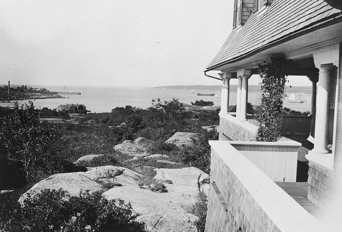
Fitz Henry Lane House, Gloucester Massachusetts.
One of the latest of Lane’s waterfront portrayals in the museum’s collection is Gloucester Harbor at Dusk, from1860. He of course painted the water and sky beautifully, with evening light. He placed himself on Duncan’s Point looking toward Fort Point, which was by then covered with wharves and buildings. A square-rigged vessel is tied up, one of the last in the Suriname trade.
Duncan’s Point is the promontory where Fitz Henry Lane chose to build his own house, a three-story granite edifice high on a knoll, in the thick of his own subject. From his studio windows on the third floor, he had a commanding view of the busy harbor and the sky’s moods. If he wanted spectacular sunsets, he was in exactly the right place to study them. His legacy to us is a gift of vision recording both meticulous information and grand environments.
Erik Ronnberg recently retired from his position as Maritime Curator at the Cape Ann Museum. He has contributed extensive research to the museum’s collections and to its website project Fitz Henry Lane Online. His masterful ship models are included in many private and public collections, including the Smithsonian Institution, Hart Nautical Museum at MIT, Mystic Seaport, New Bedford Whaling Museum and the Cape Ann Museum.


CULTURE FOLIO CONTENTS